Over to the east of the Lake District lies one my favourite summit areas, High Street stands at 828 metres (2,718 ft) high. For many reasons, near towns, main roads etc the fells over to the centre of the district get quite busy when the sun comes out but for those in the know this remote climb is a stunner.
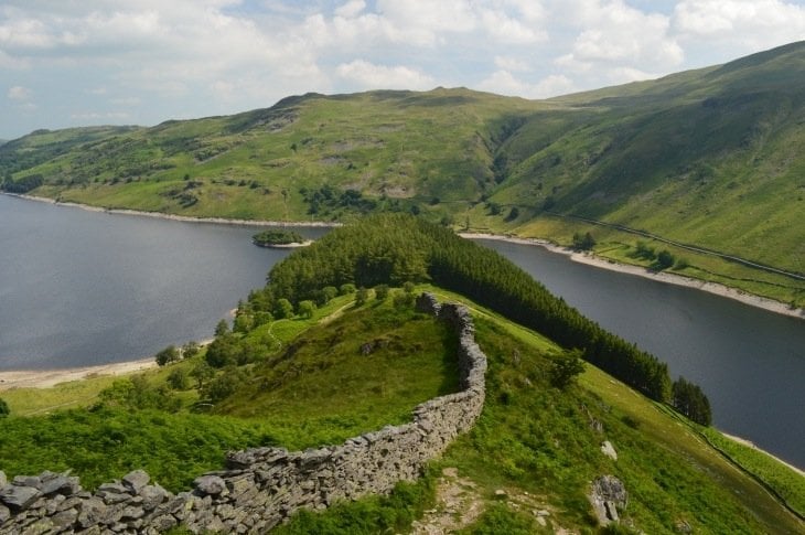
In the picture above you can see the climb, The ridge with Rough and Riggindale Crag rising up the middle of the picture from Haweswater up to the top. This route is one of my favourite circular routes in the Lake District. I have included a GPX for this circular walk below.

Why is it called High Street? then there is Haweswater the controversial lake, once was a very special bird, and the deepest tarn in the Lake District and more… let’s have a look and see.
Parking
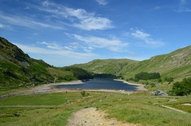
The area around Haweswater is beautiful and overlooked by many due to remoteness from the usual spots. Right at the southern end of Haweswater is a little car park, it is always good to get there early or later in afternoon for places especially on sunny days.
There is only one road along the shores of Haweswater to the car park, along its eastern flank. After the car park is a dead end, the expanse of the mountain you shall climb.

Haweswater Reservoir
Pre 1935 this lovely valley of Mardale was home to a smaller natural lake divided into almost two by land containing the villages of Measand and Mardale Green.
Down in Manchester however they needed more supply of water. So they damned up this valley and flooded it to create Haweswater that you see today, so it is now actually a reservoir.

If you get a summer of severe drought etc where the water is really low then you get to see the outline of these abandoned villages.
Riggindale Ridge
From the car park you walk around the Southern end of Haweswater’s edge and you cannot miss Riggindale Ridge then rising up to your left. It doesn’t take long to make some height and the views start coming in as you look back.

Continuing up the ridge it just gets better and better. Not just looking back down the ridge and valley or even up where you must climb. Left and right spills out all kinds of attractions.
On this day I never saw anybody else all afternoon on the ridge, it was perfect and mind clearing.

The Last Golden Eagle
On the ridge about half way up the ridge becomes a great crag. Rough Crag. You can stand or sit here and admire the views in every direction.

To your right is a quiet expanse of Riggindale Valley and when I originally wrote this article there was always a chance here of seeing the last Golden Eagle in England. Soaring amongst the mountains and within the valley.
Many years ago there was a single male and female pair here. And they had made this valley their own. The female died in 2004 but the male carried on. Visitors came from all over to view the one Golden Eagle in the country. Each Spring he could be seen putting on displays to find a new mate and the RSPB had set up a hide at the bottom of the valley.
Alas from 2016 there has been no sign of him sadly. But he was believed to have lived to a grand age of at least 20.

Blea Water
As you climb up nearer the top you get your first glimpse of Blea Water, the deepest tarn in the Lake District at about 200ft (61m) deep.

You can see the last bit of ridge to the top ahead. The tarn below to your left and you feel miles from anywhere. With all this around you I find this a great spot for lunch out and flask emptying before any exposure on the top.

The Summit Area
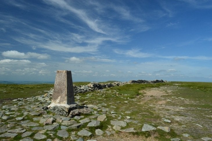
Up and up, small undaunting scrambles at times, the tarn gets lower and lower below you shimmering in the sun and suddenly there you are. The summit area of High Street opens up in frrnt of you, a very different landscape, an wide open flat summit.

Why Called High Street?
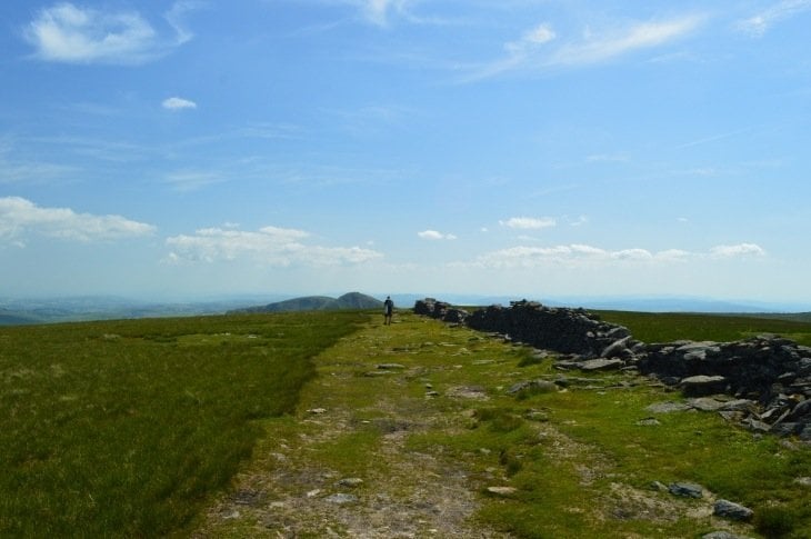
Now then, why is it called High Street? You can see in the pics above and below the path we join to head over the top is very wide and with a wide unnatural pathway.
This was once part of the Roman Road from Ambleside to Brougham near Penrith. Even today you can see the remains of the stone beneath your feet. We must remember that way way back in Roman times the valleys were not farmed as we see today but natural swamps and very thick woods. Also these flatter mountaintops provided an almost straight line over away from any potential threats from those hiding below.

The Racecourse
It is hard to believe that in the 18th and 19th Century the local population had a local fair of sorts up here on the big flat summit.
On 12 July every year the communities came to collect stray lost sheep, growing into a fair of horse racing and wrestling! If you see a map that calls this mountain ‘Racecourse Hill’ instead of High Street then that is why.

Views from the top
The views are spectacular. Westwards you get a great panorama of the mountains with Helvellyn and the Langdales standing out. Southwards as you continue to walk the Roman Road you can see the Southern Fells with the unmistakable Windermere laid out before you below.

Mardale Ill Bell
Leaving the summit and the Roman Road left you get to your second summit of the day within minutes without feeling any climb, just a gentle walk over. Mardale Ill Bell.

In the above pic you see another summit further along if you wish to, Harter Fell. However this circular now head down to the left, down along the pass.
Small Tarn
Jut because you have ascended the ridge and been across the top of High Street, that doesn’t mean the special places and views are over. Half way down you pass by another beauty spot, another tarn called Small Water.


Back to the start
From Small Water the path goes down and down and leads back to the car park perfectly. Haweswater coming back into view and its expanse looking bigger and bigger all the time

And after an absolute mind refreshing day, full sun, mountains, fresh air and interesting history, time for a pint!
Route Details
Distance: 6 miles
Parking: Free parking for a small number of cars at the southern end of Haweswater.
Parking Grid Ref: NY 468 107


I did this one last year…… breathtaking, a great climb! Thoroughly enjoyed it 🙂
yes.. a firm favourite 🙂
I can see why this is one of your favourite summit areas, what a beautiful place!
Oh what a wonderful way to wake up today! Without a doubt, this has become ‘bucket list’ material. I can almost feel the air by your descriptions. So lovely, so quietly beautiful & surprising just over the next ridge. Must take my paints and go! Thank you so, so much!
Hi Pammy, thank you. yes.. head there with your paints! 😀
Super composition…top image is breathtaking. Instead of driving through and admiring this area…these pics make me want to and explore (with my camera). your a talented man Paul.
Kind regards
Bill
Wow Paul, that is truly spectacular. Thanks for sharing 🙂