I hadn’t been away on holiday for many a year and when two friends suggested we put a walking holiday together, I jumped at the chance. We decided on the Rob Roy Way, a relatively new trail in Scotland, which was created in 2002.
Some walk details
Rob Roy’s Way starts in Drymen, in the Stirling District, where it meets the West Highland Way. The route is 128 km (79.5 miles) heading north east and finishes in Pitlochry, Perthshire. Most people do the walk in 6 to 9 days. Due to time we went crazy and di it in 5 days.
The route takes in many of the tracks and routes that Rob Roy is said to have used in the Jacobite Uprisings.
Rob Roy
Rob Roy, full name Rob Roy Mcgregor was born in 1671, Scotland. He became one of the most famous members of the Jacobite Uprisings. His life and bravery has been depicted in ways that he became a folk hero of Scotland. The early 1700s where a time that the people of Scotland wanted James II on the British throne (James VII in Scotland). An uprising occurred called the Jacobite Rising. The word Jacobite came from the the latin ‘Jacobus’ which was latin for ‘James’.
Starting out from Drymen
We started out from Drymen, the official starting place being the square, which is where you’ll find the Clachan Inn. Day one was scheduled to be about twenty one miles but with re-routing we ended up walking about twenty three, finally ending up in Callander. The re-routing is something that you may come across on a few occasions as about half of the route uses forest tracks, most of which is owned by the Forestry Commission Scotland (FCS) and constant maintenance; either felling , replanting or general upkeep needs to take place. This is always well signposted.

This first stretch uses quite a lot of cycling paths and as we started out on a Sunday morning they were plenty of cyclists enjoying the balmy September air. The first climb of the day is on leaving Drymen but having devoured our first Scottish breakfast we were ready for whatever the day threw at us.
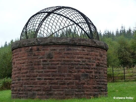
This morning’s section leads us through part of the huge Loch Katrine water scheme and there is plenty of evidence, such as the large rounded stones on the right hand side which trace the line of the 1856-9 aqueduct, which runs in a tunnel beneath your feet. John Bateman was the civil engineer commissioned with this incredible project; which went on to eradicate cholera by supplying exceptional quality drinking water to the people of Glasgow. The aqueduct is 26 miles (42 km) long with a further 46 miles (74 km) of distribution pipes, delivering the water to the households of Glasgow. Every now and then you’ll pass by dome shafts, these were used for extracting spoil and for ventilation. A little further on we come to Corrie Aqueduct; this dates back to 1859 and is still in fine working order.


Aberfoyle to Callander
We stop in Aberfoyle for lunch and a well earned coffee. A couple of places that you might want to visit are The Scottish Wool Centre and The Trossachs Discovery Centre. I got sidetracked here as there was a couple who were from a local bird of prey and owl sanctuary, introducing some of their gorgeous birds to the general public. I couldn’t resist stopping and admiring these beautiful birds; but not for long, Callender beckoned 😉
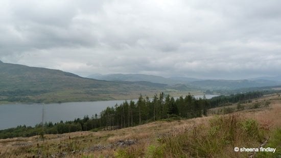
Onwards and upwards we go leaving Aberfoyle behind; our guide book mentions that this next section has some boggy areas and a few streams to cross. We’re very lucky with the weather and none of the streams that we came across were too challenging; but I can imagine after heavy rainfall this could change quite dramatically. We pass Lochan Allt a’ Chip Dhuibh and continue along the forestry road, with occasional views of Loch Venachar.


Callander to Lochernhead
Feeling pleased to have completed ‘Day one’ we spoil ourselves with the most fantastic fish supper. I can’t tell you how wonderful the seafood pasta tasted in Mhor Fish. Our Bed and Breakfast situated just of the main road, was run by a real character and his wife. The last call for breakfast was him playing the bagpipes! Fully replete we set off on day two; about fifteen miles today, Lochernhead being our destination.
The route took us along a cycle path again but that does have a bonus, you can keep a fairly brisk pace going. We decided to break for lunch at another of the delightful Mhor eateries; this time it was Mhor 84, very conveniently situated on the A84 just outside Balquidder. We knew that it wasn’t going to be easy finding somewhere to eat in the evening.
The rain decided to show its face in the afternoon, but that was the one and only day on our trail that we needed our waterproof jackets; it never got heavy enough to warrant waterproof trousers.


We were up amongst the moor land in the afternoon which was pure bliss, eventually cutting down to Lochernhead for our second night stop.
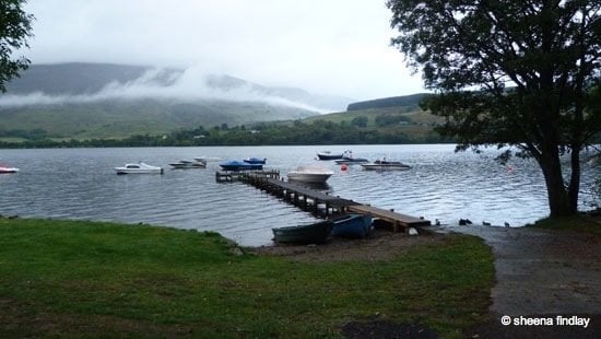
Once settled in we took a stroll down the road to the pub. The rain had eased off and the views in the dusk looking over Loch Earn were quite something. It looked as if the Mountains were letting off steam as the low cloud gradually lifted away.

Lochernhead to Acharn
After what ‘in my opinion’ was the best breakfast of our whole holiday we waddle on our way. A little bit of low cloud about but nothing to dampen our spirits. We discussed whether we were going to follow the main path through Killin or take an alternative route which would reduce our mileage considerably.

We decided on the Killin route as we all wanted to see the Falls of Dochart. It was well worth the visit. The falls are incredible and proved a very popular spot with lots of photographers.

St. Fillan’s Mill on the opposite side of the river is just one of the gorgeous photo opportunities. Watch your step though; I went for a purler on one of the stones leading down to the waters edge. Really thought I’d broken my camera not worrying too much about my throbbing hip bone!

This was our longest day with the steepest climbs and descents, nothing major, but with the mileage we needed to cover to get to our next bed and breakfast we couldn’t rest on our laurels for too long.
We had time to pass by the Clan Mcnab burial ground.

The day was full of spectacular views, lots of ‘oohs and aahs’ from all three of us. The path takes you inland up to Breaclaich Reservoir and Dam, passing close by Creag Gharbh, which is the highest point of rough ground on the South East side of Loch Tay. If it had been a clear day we should have witnessed beautiful views of Ben Lawers. After stopping for a quick lunch break overlooking the reservoir we’re off again.

Up and over the top and the scenery opens up to everything we’d expected; huge areas of moor land shrouded by incredible mountains all around. Descending towards Ardeonaig and our first spectacular views of Loch Tay; all the while we’d been walking inland we’d covered the first third or so of Loch Tay.

Once at Ardeonaig one of our girls had to be collected by the owners of our next B&B as her knee, which she had major surgery on last December, decided to cause her great discomfort. One thing to be aware of is that taxis do not come out to some of these remote locations. Fortunately we had all our lodging information to hand and they couldn’t have been more accommodating.
So with just the two of us now, we put on a bit of a spurt as we wanted to have a nice hot shower and there was promise of a rather special dinner venue. We arrived at our lodgings in Acharn just as the sun was setting. A quick spruce up and we were off out again, our table was booked for 8pm at the Taymouth Marina Restaurant. What an incredible meal we had; well we were on holiday.
Acharn to Aberfeldy
Up bright and early and after a good breakfast and chat about the stunning views we were ready to move on.

The next couple of days were much shorter and all three of us were raring to go. We’re blessed with a stunning start to the day, so I was dragging behind a bit trying to take some photos.

The RRW takes you high above Kenmore, so the views looking back over Loch Tay and Kenmore are breathtaking.

Taymouth Castle can be seen from way in the distance. This was the seat of the Breadalbane family up until 1920.

We stay quite high for most of this days walking, climbing over some incredible stiles to enable us to pass through the deer fencing. Once we reach the Birks o’ Aberfeldy we have to decide which path to take. We opted for the most direct path into Aberfeldy. We head straight to The Watermill and Homer; best known as an atmospheric bookshop, art gallery and coffee shop, to enjoy a well earned coffee and a late lunch.

None of us can resist a book shop and we spent a lovely time perusing their shelves before finally heading to our next B&B. Once we’d dropped off our bags I headed back out towards the Birks o’ Aberfeldy and walked up the alternative path.
I’m very glad that I did as I got to see the falls at their best; there are numerous viewing areas but the best has to be near the top where you’ll find verses from the famous song The Birks o’ Aberfeldy carved on a wooden plaque.

This is also the path where you’ll see the bronze statue of Robert Burns.

Aberfeldy to Pitlochry
We’re off bright and early on our final leg of the RRW, another short day for us, about ten miles. As we leave Aberfeldy the path takes us past Dewar’s World of Whisky, our timing was unfortunate as it was closed. Perhaps that was a good thing.

The path runs alongside the road for a bit but it’s not too long before you cut down to towards the River Tay, staying on the south bank. Gradually the path heads up towards the embanked trackbed of the old railway line, this takes us through to Grandtully.

Having crossed some open moorland and negotiated a boggy area, we then head into Fonab Forest. The weather’s closed in a bit, so we missed out on some of the spectacular views we’d read about.

Suddenly there’s a clearing and we see the 3600 year old stone circle, Clachan an Diridh. Three of the stones are standing and the fourth lies flat in amongst them.

On leaving Fonab Forest we have to negotiate crossing the A9, a very busy, fast road. Not far now; this is where you have an option to divert and check out Pitlochry Festival Theatre, which is exactly what we chose to do. The programme at the Festival Theatre is extensive and well supported. We couldn’t find anything that suited all three of us so we opted to book a nice restaurant instead.

We got to the War Memorial which marked the end of The Rob Roy Way. An incredible five days taking in some of the beautiful scenery of Scotland.
The next day we take a train back to Glasgow and a friend gives us a lift back to our car. Time to head home and put some plans together for another adventure.


